Mapping Solutions for Your Cemetery
We understand how important it is for cemeteries to have a detailed view of their grounds, provide knowledge to the public, and manage grave inventory. Our mapping solutions will allow you to visualize and utilize your cemetery data like never before. Click below for more information on each mapping solution product we offer.
Grave Mapping

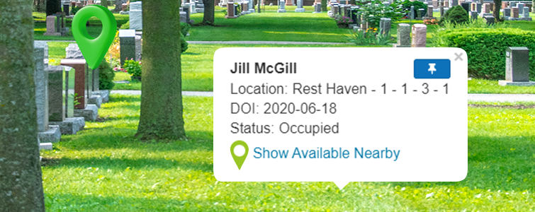
Empower your staff and the public with grave information available on demand. Grave Mapping links the owner of each grave to the deceased and the property location. All of this information is displayed on the core customer record, the hub for all information associated with any customer. Implementing this powerful tool gives visibility to unknown and incomplete data you never knew you had. Search for available graves nearby, by either lot or section.
Walk-to-Site

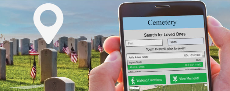
Give your community the ability to easily search for a loved one and get walking directions directly to a gravesite with our Walk-to-Site add-on, powered by GPS technology. Visitors can also scan a QR code and go to the search page instantly. Once they look up a loved one, they can view a full online memorial with an obituary, pictures, videos, and condolences from friends and family. Walk-to-Site never takes a day off, so you’ll never spend time drawing maps or showing visitors to a gravesite again. You don’t have to be at the office to help your visitors find loved ones, either. They always have access with Walk-to-Site.
Marker Manager

Quickly get a full picture of your existing grave markers in a simple, organized view with the Marker Manager add-on. Plus, create great upselling opportunities by running reports on graves without markers. Track your orders through the shipment, delivery, and receivables processes. Marker Manager gives you a great visual representation of your cemetery, especially when you pair it with our Visual Lot Viewer. In one simple glance, you will be able to see exactly which graves have markers within each lot and all of the data that pertains to each one.
Niche/Crypt Viewer

Visualize and present your mausoleums and columbariums online with the Niche/Crypt Viewer. Get the big picture of your inventory with digitally-replicated custom layouts that match your mausoleum and columbarium walls. Customers and staff will be able to easily view each wall and search to see location and availability to buy or reserve crypts and niches online. Easily add and edit records, or rearrange property as needed with simple drag and drop functionality.
Obstruction Manager

View and mark obstructions in your cemetery with the Obstruction Manager. Clearly mark the locations of trees, benches, buildings, rocks, and other obstructions in relation to graves on interactive, digital maps. Know exactly where you can and can’t sell without having to go onto the grounds.
Visual Lot Viewer

Find available graves in seconds directly from your cemetery grounds or the comfort of your office with Visual Lot Viewer. Visual Lot Viewer visually connects burial, grave, owner, and marker information with their physical location. It also saves you time and simplifies your workflow by serving as a launchpad in your software, taking you directly to the associated customer account. With easy-to-use lot editing and verification tools, Visual Lot Viewer is the best graveside reference available on the market today.
Drone Mapping & Flyovers

Bring your cemetery grounds to life with our aerial drone technology and flyovers. Drone imagery enhances your view of all of the details within your cemetery and creates crisp, interactive cemetery maps. This improves the experience for the public searching for loved ones in addition to allowing you to create innovative marketing materials for your cemetery with professional drone photography and drone video. We can also add a flyover while using the drone to photograph and record images of your cemetery, giving you and your guests the ultimate visual experience.
Map Printing

Search and print cemetery maps for any section or lot of your cemetery as a handy reference tool for both your grounds crew and visitors. Simply search for a grave and print to supply a helpful map directly to your visitors. Our maps show the mapping level requested, such as lot level or grave level. Each map features both close-up and panned-out views showing the location within the cemetery. With these two views, people can find graves with ease. You’ll always have quick and easy access to up-to-date, detailed maps with the Map Printing Module.
